
AIChatbotGeospatial
Disaster Management
Built an OpenAI-powered disaster response assistant integrated with a geospatial damage-assessment dashboard. The chatbot sits alongside the map with direct access to VLM-derived building damage data — so users can explore, filter, and visualize impact through natural language instead of manual map navigation.
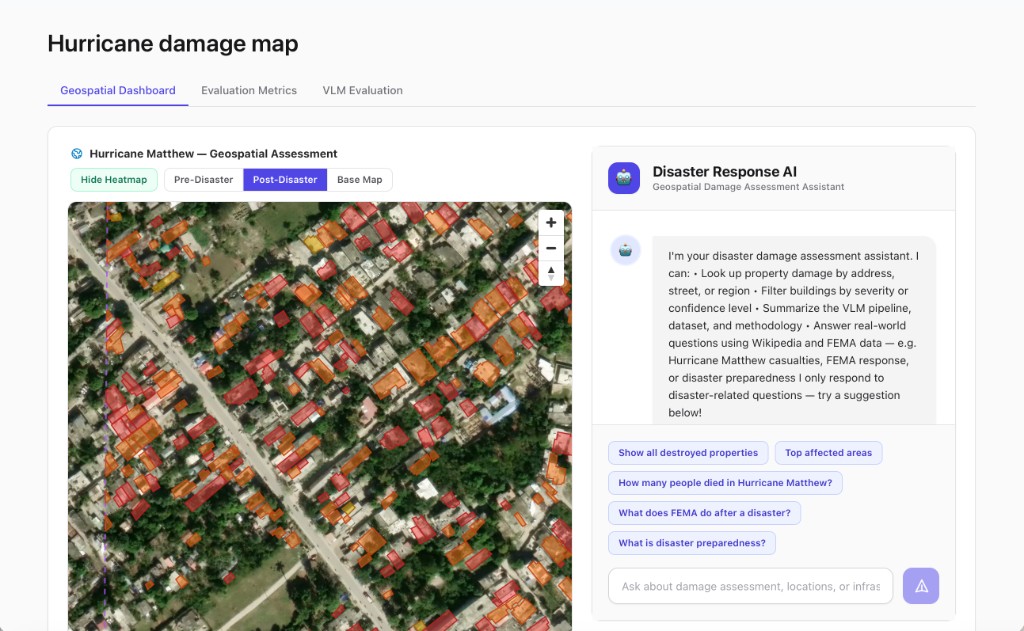
Disaster Response AI Chatbot
Built with OpenAI and embedded on the dashboard next to the geospatial map, with direct access to assessment and location data from the VLM pipeline.
- Query-based map visualization — users ask the chatbot to highlight specific damage patterns, severity levels, or boundaries directly on the map.
- Statistical queries — aggregate questions such as how many structures were destroyed or which areas were most affected.
- Disaster information queries — details on when an event occurred, its broader impact, and related response or preparedness context.
Shown: Hurricane Matthew geospatial assessment with post-disaster satellite overlays, color-coded building damage, and the integrated chat assistant. Live at disaster-detection-group6.vercel.app.